SatelliteImageEnhancer
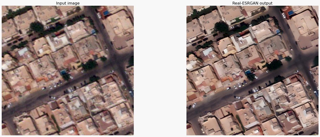
This technology, developed by GeoTech, extracts images from satellites and then applies artificial intelligence to enhance their quality. The aim of this process is to improve clarity and accuracy, enabling their use more effectively across a wide range of applications. These applications may include environmental monitoring, urban planning, precision agriculture, and geological studies. By enhancing image quality, this technology contributes to providing more accurate and detailed insights, enabling researchers, planners, and various institutions to benefit from improved spatial data to support strategic and operational decisions
Our SatelliteImageEnhancer offerings come with a commitment to security and individualized service. For a tailored discussion on how this technology can benefit your organization, please reach out to us